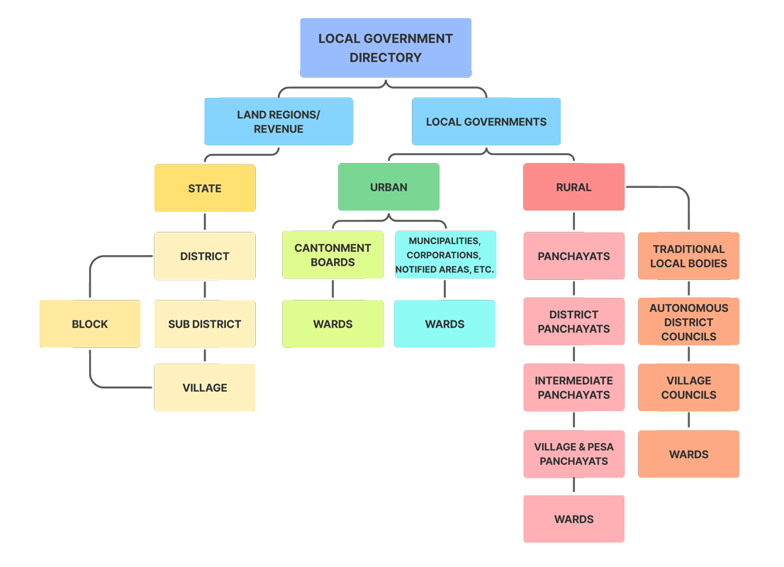
LGD (Local Government Directory) is one of the applications developed under the Mission Mode Project of Ministry of Panchayati Raj. Primary objective of LGD is to facilitate State Departments to update the directory with newly formed panchayats/local bodies, re-organization in panchayats, conversion from Rural to Urban area etc. and provide the same info in public domain. LGD application assigns a unique location code (LGD code) to the existing and every new local Government body that gets created in the system. Current stakeholders to this application are Revenue Department, Registrar General of India, Rural Development Department and Urban Local Governance Departments. More Departments are adopting it.
LGD codes are currently being seeded to e-Governance applications of various Ministries/Departments to ensure interoperability of data and thus achieve transparency in the system. The resources being deployed by line departments can be known for Panchayats.
- Local Government Directory
- Land Regions / Revenue
- State
- District
- Block
- Sub District
- Village
- Block
- Local Governments
- Urban
- Cantonment Boards
- Wards
- Muncipalities, Corporations, Notified Areas, Etc
- Wards
- Cantonment Boards
- Rural
- Panchayats
- District Panchayats
- Intermediate Panchayats
- Village & Pesa Panchayats
- Wards
- Traditional Local Bodies
- Autonomous District Councils
- Village Councils
- Wards
- Urban
- Land Regions / Revenue

DO letter
- Letter to all Union Ministry for Mapping of LGD codes
- Letter to Union Ministries
- LGD Brochure
- LGD updated manual
- Cab Sec Letter 04-11-2016
- Letter from MeitY for adoption of LGD


